Selsey West Beach (Medmerry) [IMPORTANT INFORMATION]
7th May 2012, low tide 0.3m at 1846
IMPORTANT INFORMATION FOR POTENTIAL VISITORS TO MEDMERRY OR WEST BEACH SELSEY
COASTAL PROTECTION WORK – WEST BEACH, SELSEY
I have now met with the Site manager and have a better understanding of the works taking place.
This beach is going to have limited / no access probably until September 2012.
The two causeways currently under construction will be temporary structures to enable access for building two offshore breakwaters, each with a two-acre footprint (the size of two football pitches). The seabed will never be exposed here. The beach will also be built up between the two breakwaters, which are 610 metres apart. The temporary causeways will be removed when the two breakwaters are completed.
To carry out the work, 93,000 tonnes of granite rocks will be brought in by ship from the Larvik Quarry in Norway. The core of the breakwaters will be built from 0.3 to one tonne rocks, while the outer or 'armour 'layer will be built from six to 10-tonne rocks.
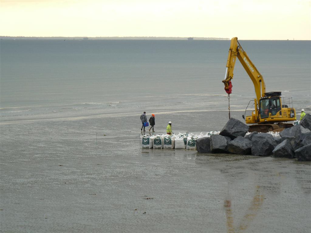
In the final stages, the beach will be restored and enlarged with half a million tonnes of sand and shingle. The result will be a shingle beach between 25 and 100m deep leading down to the sea. In a process called 'shingle beach recharge', 115 vessel trips will each bring 3,000m3 of sand and gravel to be pumped through a pipe leading from the dredger to the beach. The sand and shingle will then be profiled by bulldozers to form the beach.
Selsey West Beach (Medmerry) [IMPORTANT INFORMATION]
6th May 2012, low tide 0.3m at 1800
IMPORTANT INFORMATION FOR POTENTIAL VISITORS TO MEDMERRY OR WEST BEACH SELSEY
COASTAL PROTECTION WORK – WEST BEACH, SELSEY
In addition to the Medmerry Sea Defence works being carried out by the Environment Agency, a further Coastal Protection Scheme funded by Bunn Leisure commenced this week
This scheme is being privately funded (£16.8m) to help protect the Bunn Leisure Caravan site. Bunn Leisure is a major employer in the area and is a vital part of the Selsey economy.
This Coastal Protection Scheme received planning permission back in 2009.
The works are planned from April through to September 2012 and coincide with the adjacent Environment Agency Works. (For information, the breakthrough of the Medmerry Sea Defence by the EA is planned during 1Q2013.)
Access to the beach is very restricted and can only be achieved on a good spring tide.
WARNING: The flood of the tide is quite fast so you may find your exit from the beach difficult.

Details of the Coastal Protection Scheme
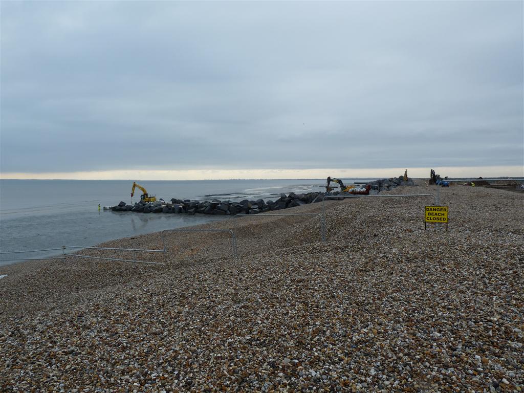
View from the top of West Beach. Note the Fence and the CLOSED BEACH sign.
A small patch of S7i showing behind the West breakwater. Flag base just visible on the low water mark on the right of the picture.
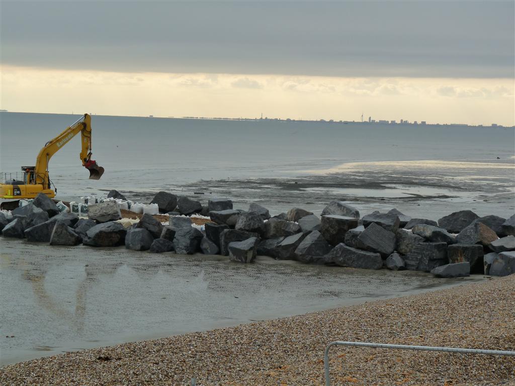
The Westerly breakwater under construction and about 30 mins before tide flood.
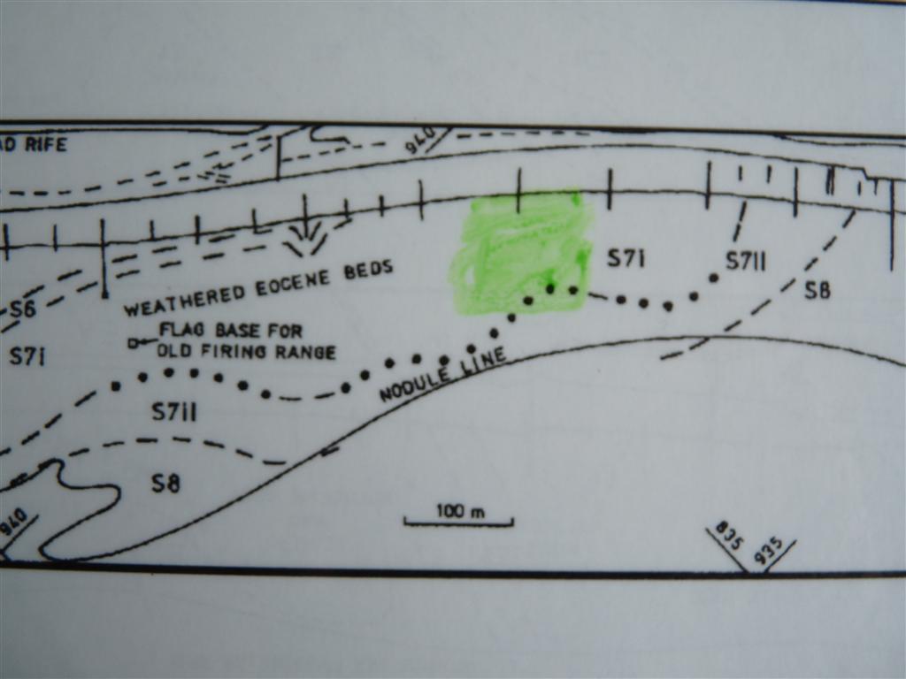
Approximate location of the exposure described above.